- History of Smith-Corona Typewriters: From Shotguns to Spell Check - December 27, 2021
- Vintage Navigational Tools (And How They’re Useful Today) - December 25, 2021
- A Guide to Prohibition Era Clothing & Styles - December 23, 2021
If you’re on the search for unique items to collect, vintage maps might be something to contemplate. They’re not only beautifully designed but allow you to see how various areas have changed over the years.
However, knowing where to begin can be difficult. This article will explain some of the most important things to keep in mind and how you can start foraging for these navigational treasures.
What is a Vintage Map?
A vintage map is around 50-70 years old. Anything older than this would be appraised as an antique.
Types of Vintage Maps

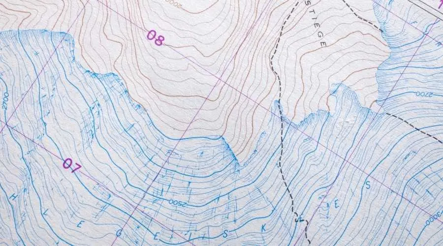
A key thing to consider is the type of vintage map you want to collect. The most common forms are:
- Planimetric (displays aerial views)
- Thematic (shows geographical patterns)
- Topographic (highlights detailed imagery of local geography)
- Navigation (combines both planimetric, thematic, and topographic elements)
- Cadastral (used to determine real estate values)
Fakes, Forgeries, and Facsimiles – What’s the Difference?
As you search for vintage maps you’ll come across non-authentic types. These fall into one of three categories. Here is more about them and how they differ.
Fake
A fake map is one that was altered to appear old. For instance, the paper might have been stained to appear worn.
Forgery
A forgery is meant to intentionally deceive. While it’s a fake map, it was touted as something that it wasn’t.
Facsimile
Facsimile objects are meant to intentionally trick those who might not have intensive knowledge in a specific area. But, unlike a fake or forgery, it will contain slight differences.
Related: Learn about the different types of globes used throughout history.
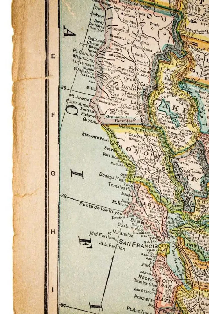
How to Determine If a Map is Vintage
While a map might look faded and utilize old fonts, that doesn’t mean it’s actually vintage. Instead, it could be a well-designed replica. To prevent buying a fake map you’ll want to use these tips.
Look For Signs of Aging
The older the map the more likely it has signs of aging. No matter how well the map has been preserved, over time, the paper will start to yellow and the edges could turn a bit brown. The corners could also be slightly folded.
See If There’s a Middle Fold
A large portion of old maps was sewn into atlases. To ensure these maps fit snugly, they would be folded in half. Because of this, if you notice a crease in the paper, it’s probably an original.
Review the Color
Many vintage maps were colored by hand. To make sure the colors didn’t bleed into nearby areas, the artist would carefully paint the colors and lines by hand. But, those printed by a machine will have matrix dots. These differences can be tough to tell at first glance, but with the assistance of a magnifying glass, you can inspect the map.
Check Its Size
Many reproductions will shrink the size of the original map or enlarge it to great proportions. While some vintage maps come in these dimensions, anything that seems too excessive probably indicates it’s a replica.
Probe It for Fine Print
To protect themselves from legal problems, some map replication services will hide the map replica’s printed date in fine print somewhere. They’ll also stamp their logo alongside it.
Examine Its Quality
Because many vintage maps were made by hand, they have crisp lines. However, to mass-produce some, copies would be sent into machines. These devices would often mess up the lining causing some areas to slightly blur.
Caring For Vintage Maps
To keep your vintage maps in good shape you’ll need to maintain them. Here are some suggestions.
Insert Them Into Mylar Sleeves
Mylar sleeves are a useful way to protect maps. You can slip the map into the sleeve which will act as a thick film. This will safeguard it from UV rays and smudges.
Keep Them Out of Bright and Humid Conditions
One of the worst things you can do with old maps is put them in bright sunlight or moist rooms. This can cause the paper to fade and warp. Instead, verify that the room is cool and doesn’t exceed 70℉.
Use Acid-Free Framing Equipment
If you prefer to display your vintage maps, always use acid-free utensils. If a matte, frame, or glue has acidic properties, small particles can eat away at the map. This could cause it to peel and eventually decompose. Many times, conservators recommend fastening old maps to Japanese paper which is gentle on delicate materials.
Researching Old Maps

Before you start investing in maps for your collection, you might want to do some research first. This will give you a better idea of what to look for during your search.
There are countless options you can use to investigate old maps. A few online resources to use include databases from:
- The Library of Congress
- The U.S. Geological Survey
- The David Rumsey Historical Map Collection
You could also contact a historian who can guide you to the best places to discover authentic vintage maps. Better yet, visit a nearby history or art museum where they usually have some on display.
Vintage Cartographers
During your journey, you’ll also want to keep an eye out for works by iconic cartographers. Below are a few to look for.
Richard Edes Harrison
Harrison is known for transforming the way America used maps during the 1930s-1950s. His aesthetically-pleasing pieces are popular for their different perspectives. He rejected the traditionally used Mercator projection and instead utilized the azimuthal projection.
Erwin Raisz
This mapmaker is notable for his physiographic maps of world landforms. Raisz used a distinctive pen and ink style which let others easily view the map’s details. As computers started to become more relied on to create maps, Raisz spurned them and instead preferred to keep producing them by hand.
Louise E. Jefferson
In the early 20th-century, Jefferson was one of the first African Americans to become a prominent cartographer. While she faced racism throughout her career, Jefferson eventually found freedom in working for the Friendship Press. She created various pictorial maps during this time, including one that documented African American lineage throughout the South.
Marie Tharp
Marie Tharp sketched hundreds of oceanographic maps during her lifetime. Alongside Bruce Heezen, she published the first map of the Atlantic Ocean’s seafloor. To make her maps, she used echo recordings from ships that crossed the Atlantic. This allowed her to understand depth better and where there might be barriers. As she drew the maps, she used a revolutionary new technique called a physiographic diagram which helped her convert the findings into 3D-like images.
Where to Find Vintage Maps
There are a vast amount of places you can search for vintage maps in. Whether in antique shops or on online auction sites, you have plenty of options. Some sites to consider browsing are:
- Art Source International
- Maps of the Past
- Pine Brook Maps
You could also visit Etsy or eBay where you could discover some rare options. However, be careful when doing so as some sellers could be dishonest about the item.
Vintage maps are a wonderful way to see how cities and towns once looked and how much society has changed. While they’re easy to collect, you’ll need to do a bit of research before doing so. By using this information, you can easily get started on collecting them.